Carlisle to Settle on foot
Riding on the Settle to Carlisle railway gives spectacular views of the scenery through which the line passes, but is not the best way to appreciate the magnificent structures of the line itself. To do that, you need to look at the line and its structures from different angles, which means that you need to be off it. You can see the line from the road at many places, but if you are prepared to walk away from the roads, there is far more to see than if you are confined to a car.
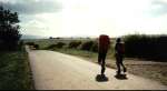
In August 1989, egged on by my12 year old daughter, I walked from Carlisle to Settle with her and her brother. I wanted to get pictures of the line and its surrounding scenery, and we also wanted to include some hill walking. The children had all walked up their first (small) mountains at 3 years old, so we were both seasoned fell walkers. The pictures here give a few glimpses of the country through which we walked.
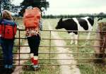
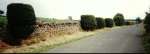
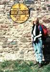
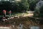
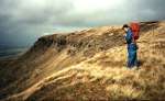
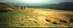
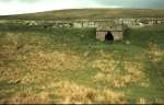
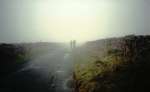
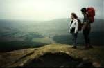
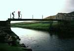
The northern part of the walk is through farmland in the Eden valley. Cows were no surprise, but the topiary by the road side was unexpected. The quaint old AA road sign was also something I hadn't seen anywhere else. Further south, after crossing the North Craven Fault, the terrain becomes more mountainous (and the weather less kind). After leaving Kirkby Stephen we climbed up onto Mallerstang Edge, where the rain cleared after lunch to give us some dramatic views, including the railway a mile across the valley and 1000 feet below us. The geology here alternates between gritstone (which supports coarse grass and peat) and limestone (where the thinner soil is more fertile and the grass is greener). Down in the valley there was good walking along a 'green road' that took us past a lime kiln. The next day was damp and misty as we walked up over the 'Coal Road' from Garsdale to Dent, and the picture here is a reminder of an aspect of Pennine weather that doesn't often find its way into pictures. From Dentdale we again took to the high ground, and in the picture on Blea Moor they were standing directly above the famous tunnel, looking back towards Dentdale where the railway sweeps round the edge of the hill some 300 feet above the valley bottom. On the final day walking down the Ribble valley to Settle we had to cross the river on a 'bridge' that was just a narrow piece of timber with a flimsy wire handrail.
I later wrote a longer article about this walk, with much more detail.
Pictures
Click on images for a larger version.
All material Copyright © 1989 John Harrison.