| Home page | Bellringing | Talks and slide lectures | Fell walking | Settle to Carlisle | Metal sculpture | Brickwork | Journeys | Ergonomics | The rest | Site map |
I grew up in Kirkby and went to school in Mansfield . They have both changed a lot since then, but these pictures give a few glimpses of how they looked in the 1960s. They aren't a systematic record, most of them were taken on a couple of days walking round, once in 1965 trying out my camera and a new type of film, and again in 1968 when visiting. I've also added some older pictures of Whit Walks, and some pictures from the 1970s & 80s .
One big difference between then and now is the railways. Kirkby had three stations and the area where we used to roam as children was criss-crossed by railway lines. Most of that has gone. There's a single station on the Nottingham to Worksop line, though it ia on the former GNR alignment (the only line that didn't have a station originally) rather than the original MR alignment. The goods line to Pye Bridge also takes the same route through the town. Some of the disused formations are still visible but some have been bulldozed.
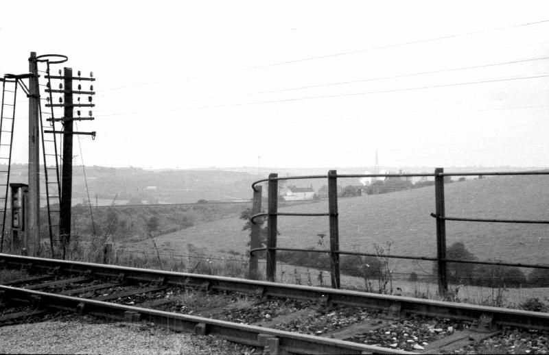
The first picture was taken in 1965, looking across the track several hundred yards south of the Central station, which had closed a few years earlier, near the high embankment on which it crossed the Erewash.
In the middle distance is the line leading to Bentick Station, behind the hill on the right, also on an embankment. The two lines crossed the Pye Bridge line and then joined before going through the tunnel to Annesley.
The house framed by the railings is on Laburnum Avenue, and in the far distance I think you can see some of the buildings at Bentick Colliery.
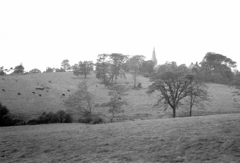
The second picture was taken from the other side of the railway, looking further right, towards the church, with the land sloping down from the railway and then steeply up where cows are grazing in the Church Field. To the right of the church you can see the roof of the Rectory (now a private house) and on the skyline to the left are some of the houses on Church Hill.
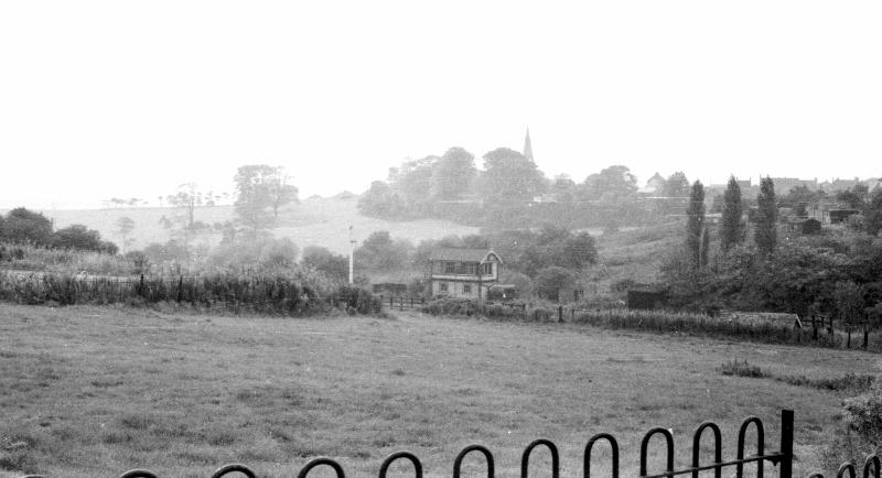
The next view was looking from the end of Beech Avenue across the valley towards the church. The railing in the foreground was the boundary of the land of Martin's Sweet Factory. You can just see the edge of the outdoor swimming pool for the workers in the horizontal area on the left surrounded by bushes. (I don't remember seeing it used, though I regularly walked along that path.
Beyond the factory land is the a signal box and signal post on the Central railway. In the middle distance on the right, behind the three poplars, is Scothern's smallholding. The distant open space on the left is Church Field. The bushy area by the clump of trees part way down was around a damp, hollow area where Gunnera (like giant Rhubarb) used to grow. Maybe it's been filled in now.
In the far distance is St Wilfrid's Church, with some of the roofs on Church Street also visible on the skyline.
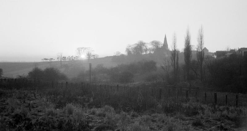
This 1968 pictures was taken from a bit further down the path (the church appears closer to the poplar trees). The signal and the signal box (which was next to the telephone pole) had both gone. The grass in the foreground obviously hadn't been mowed for some while, and was turning to scrub.
This 1965 picture was taken from the area alongside the track south of the station (which I assume used to be sidings though they must have been removed before I knew it) and shows the signal box
The two pairs of houses above the signal box are at the start of what was then the tarmac part of Orchard Road. Between there and Chapel Street was not made up, and so full of muddy potholes.
The long footbridge in the middle distance took the path from Beech Avenue (off to the right) over the old sidings and the railway, to the bottom of a steep unmade track up to Orchard Road next to the second house visible.
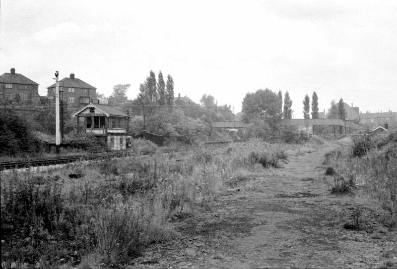
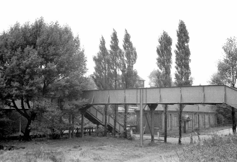
This closer view of the footbridge shows the station yard and the main building with boarded up windows behind it. To the left of it you can see part of the canopy of the northbound platform.
As well as taking the footpath over the railway, it also linked the far platform with the main building – you can see the stairs up from this side, and there were stairs down to the other platform too.. One odd feature of the bridge is that the two halves were at different levels. You can just see through the trees that to part over the tracks is several feet lower than the part over the old sidings. I have no idea why.
The station is in a cutting, and while the station was operational the banks either side were full of bushes and flowers. Thanks to the station master, Mr Brownlow, who kept the gardens looking immaculate – all the more remarkable because he had lost one arm.
This was all replaced with industrial buildings, with the Station Drive renamed New Line Road and extended to serve them.
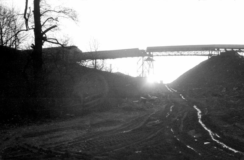
Most of the 1968 pictures were taken near Bentinck colliery. The first was looking across the mill pond towards the colliery. The pond, which was the other side of Mill Lane from the colliery isn't on modern maps so I assume it has been filled in.
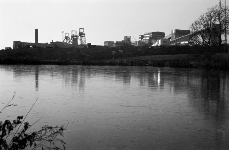
This view was taken from a spoil heap above the Mill Pond looking towards the town. Behind the railway bridge over Mill Lane are the houses on Laburnum Avenue. The church, and houses on Pennine Drive are on the skyline.
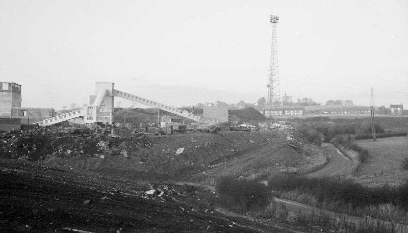
This closer view was from the bottom of a spoil heap.
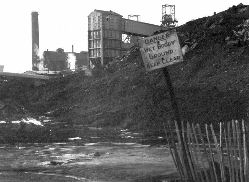
Another view from between spoil heaps of an aerial conveyor belt.
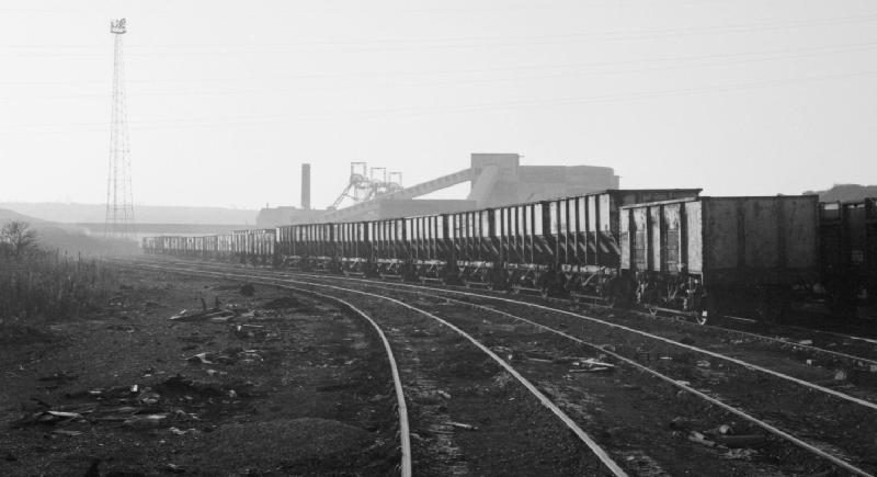
This view (possibly taken from the '44 steps' shows the colliery in the distance behind a row of parked wagons
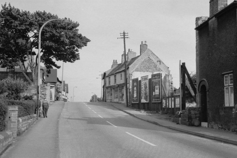
Here are two more 1965 pictures taken in the town. The first was looking up Cockett Hill. That name no longer seems to be used. In the 1960s it was known as both 'Cockett Hill' and 'The Hill', though the shorter name seems to have supplanted the older one. I was told the name was a corruption of 'Cock at Hill', with the implication that it was a venue for cock fighting at some time in the past.
The telephone pole and the hoardings have long gone, as has the house on the right. I believe the row of shops beyond the telephone pole are still standing, but not shops any more. However, the tree is still there (when I last looked) though now well over 50 years older.
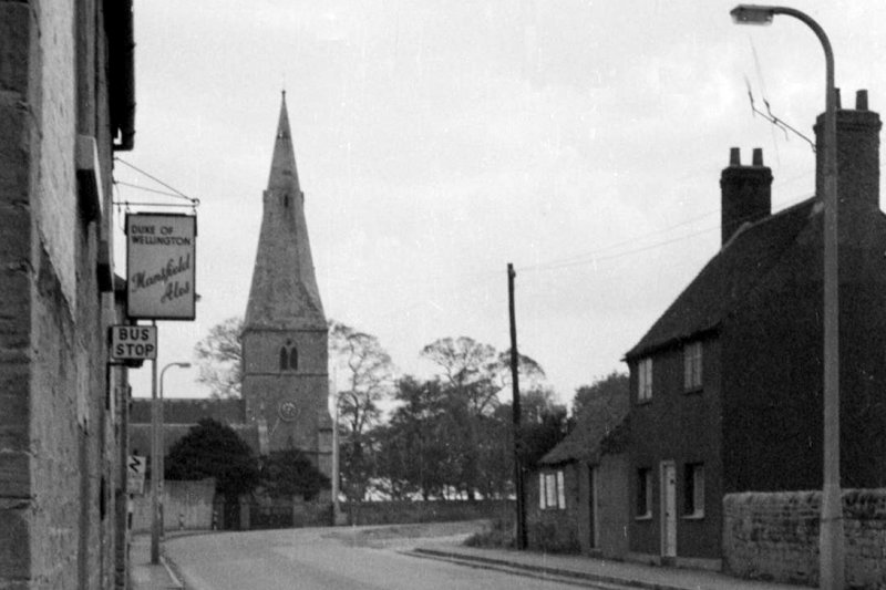
The last view is in Church Street, taken from just outside 'The Duke'. Manor Farm had already been demolished, which removed the tight blind bend by the Church, but the church car park had not yet been built, so the wall on the left of the church gate was still full height, enclosing the old rectory vegetable garden.
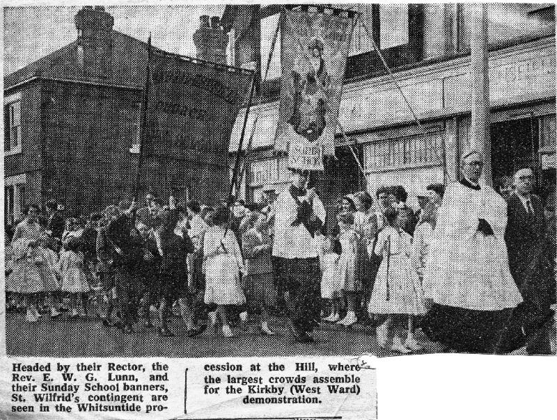
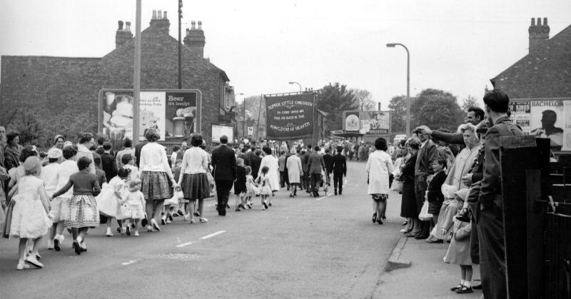
Another feature of Kirkby in my youth was the annual Whit Walk. The walkers came from all the churches – choirs, Sunday Schools, etc – accompanied by brass bands, but it seemed that everyone who lived anywhere near the route turned out to watch. The walk started somewhere near Bentinck Methodist church (which I think has gone, like the station) and came up Church Hill were we joined in . It went along Church Street, down Chapel Street and then in a big loop before coming back to the playground of the Chapel Street school where it ended with some sort of service. I think the route must have changed because the late 50s picture in the newspaper cutting shows the walk heading east past the Co-op on Victoria Road, but the other pictures (in the late 50s or early 60s) show it going up Southwell Lane and then going west down The Hill and over the railway bridge towards the bottom of Greenwood Drive.
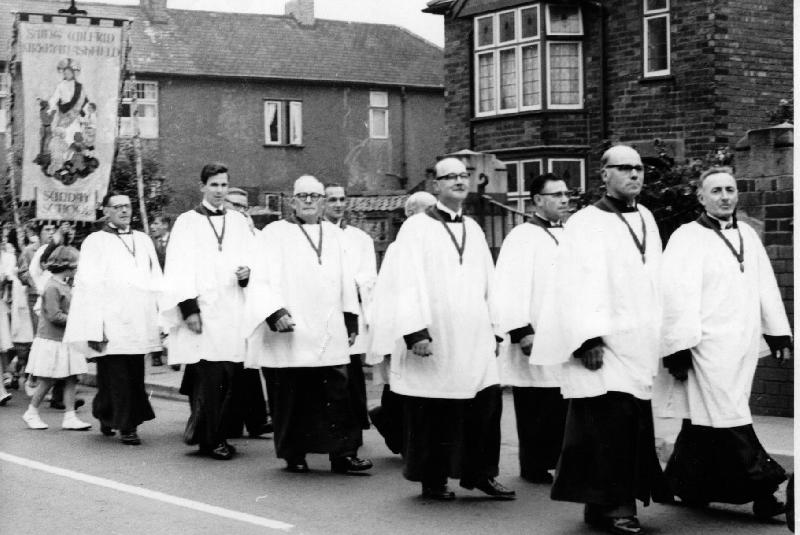
This newspaper cutting must be from the early 1950s since Eric Lunn was Rector from 1954 to1959. The walk is heading east past the Co-op at the end of Park Street. The house at the back was Dr Mcombe (if I remember correctly). The first banner was the church banner, which I think was relatively new. When not in use was kept in the corner of the sanctuary at St Wilfrid's. The second banner, with two poles, was known as the Sunday School banner (blue if I remember correctly). The only time I ever saw it was on these walks, so I assume it was stored the rest of the time. Having two poles carried by different people made it hard to control, even with people holding the guy lines (you can just see the woman in a dark dress has her arm up holding one of them). I don't think it was used in later years.
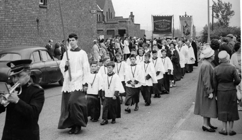
The next picture was in the early 60s probably 61, 62 or 63 since Derek Brin (in a dark cloak to the right of the banner at the back) arrived as Rector in 1960 and I (carrying the cross) was at university by 1964. The walk is heading up Southwell Lane. The Hill Methodist Church is visible at the back and you can see their banner to the left of ours. I think they are waiting in Central Drive for their turn to join in. You can tell we have just come over the railway bridge from Chapel Street because the crowd on the left are across the road at the bottom of The Hill, and the women on the right are clearly looking for someone further back in the parade. Behind the banners you can see the Lombardy Poplars near the Central station (see earlier pictures of the station). You might recognise some of the boys – now old men of course.
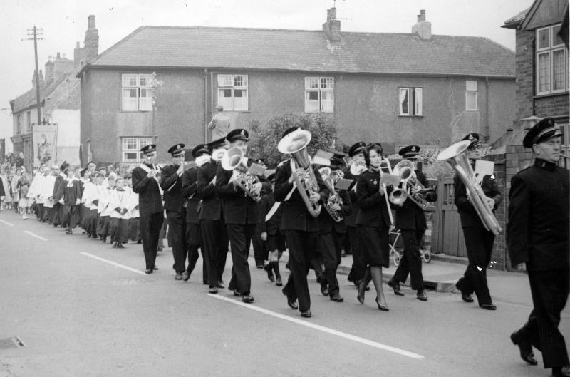
Here the walk is coming down The Hill on the return part of the route. Our banner is hiding the wet fish shop, which was at the right hand end of those four shops. The row of houses is one of several in Old Kirkby that were built end-on to the road, but it's no longer there. I'm not sure whether this was the Salvation Army Band. The dress looks right but the badge isn't like their current one. Notice the man in the garden behind the band, standing on top of something very tall to take a photo.
The next picture was taken half a minute later and a few yards further on, with the same houses in the background. You might recognise some of the men in the choir, though I doubt any of them are still alive. The Rector, Derek Brin, is just visible at the back.
The last picture in this set is on the final part of the walk, crossing the bridge over the Central Railway towards Chapel Street. The shop on the right is at the bottom of Greenwood Drive and the shops on the left are just before Orchard Road (which in those days was unmade with potholes on the stretch before it bends right and had a tarmac surface). The number of hoardings is very noticeable – on the end of both shops and behind the bus stop (an area that had recently been cleared for use as a car park). The white road sign to the left of the banner is a school sign, and I think the dark stone cappings of the school gateposts are just visible beyond it.
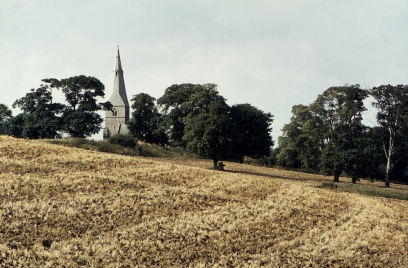
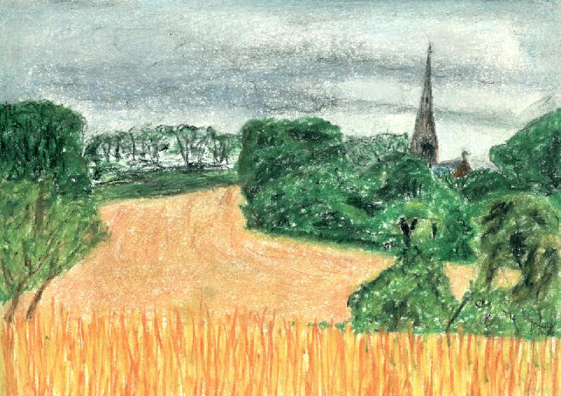
After leaving home I still visited my parents. The picture below was taken in August 1974 – after the Rector had sold off the Church Fields, and the new owner (Mycroft) had ploughed it up to grow crops. Before that it had always been pasture, and we could roam freely across it, but with crops on it you could only walk along the path. The picture is looking up the field, over the castle mound towards the church.
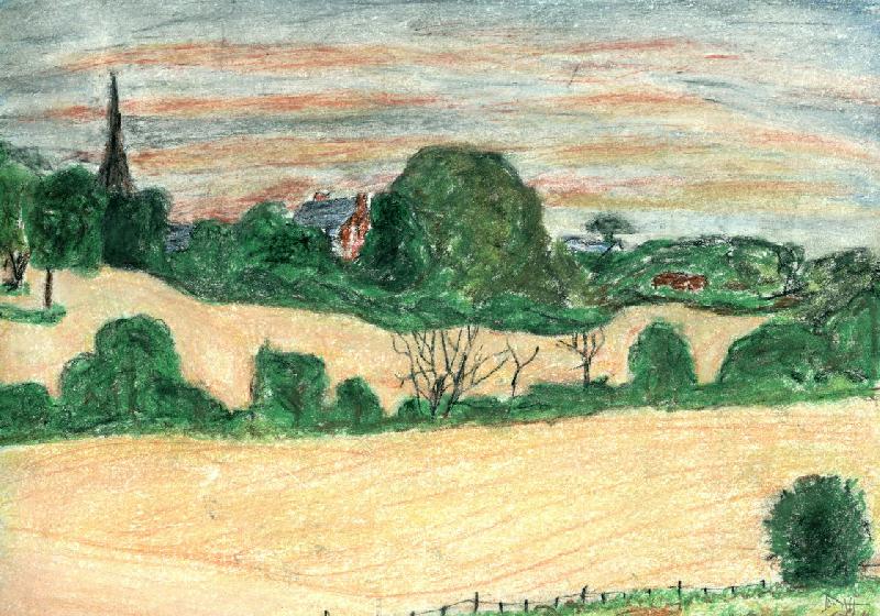
In the 1980s I took up sketching, and the pastel drawings below were made during a visit in August 1985. The first was a similar aspect but from the other side of the valley, showing the Rectory as well as the church. The trees half way up the field on the left are around one of the hollows that had been fish ponds in earlier times.
The next was from the same place, but looking more to the west. The trees on the skyline might be the conifers around the detached graveyard.
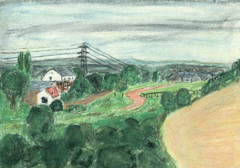
Two days later I drew the next picture, looking south towards the cottages on Laburnum Avenue, with the old railway embankment in front, and the rooves of the houses at the bottom of Church Hill & Mill Lane on the right.
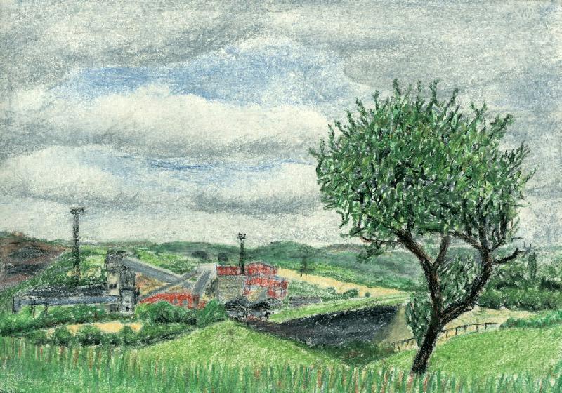
The next picture shows Bentinck colliery, farther down the valley.
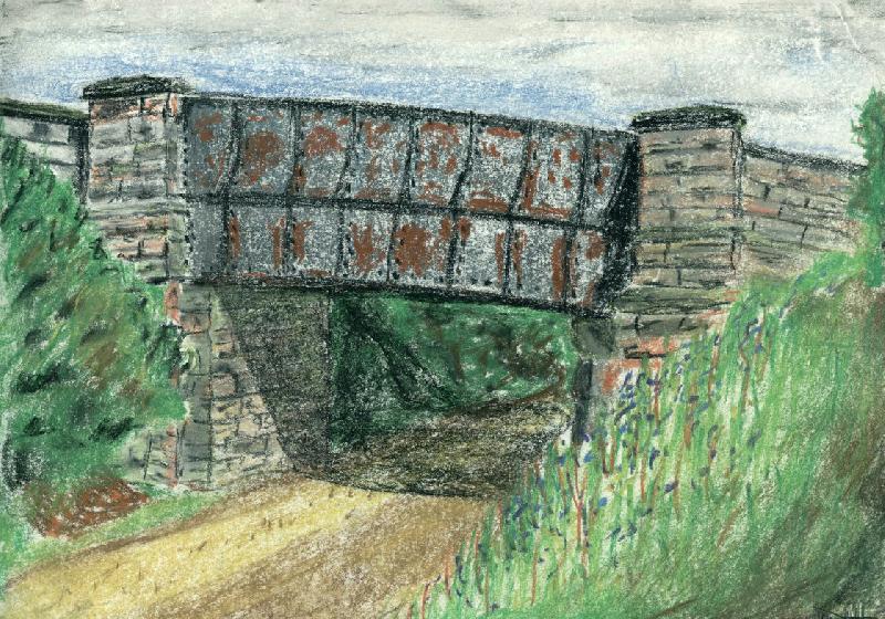
On the day between drawing the previous pictures I walked up the line of the old Central railway and drew this picture of the bridge where Sutton Middle Lane crosses the line between Southwell Lane and the top of Greenwood Drive. The extensive rust shows many years of neglect. The bridge is no longer there, and the cutting has been filled in.
If these pictures bring back memories, feel free to get in touch . Likewise, if you think I've remembered anything wrongly, please let me know.
All material Copyright © John Harrison 1965 – 2020
You may also be interested in: Pictures of 1st Kirkby Scouts Pictures of Mansfield
| Back to top | Back to Various other things | Return to Home page |